
Ever heard of a Nuraghe? Neither had we. Until about a week ago.
It’s a tower. But let me explain.
Climate, off-road trails and going somewhere we’ve never been all played into us picking Sardinia as our February base. What we did not spend much time considering is the island’s place in the ancient world.
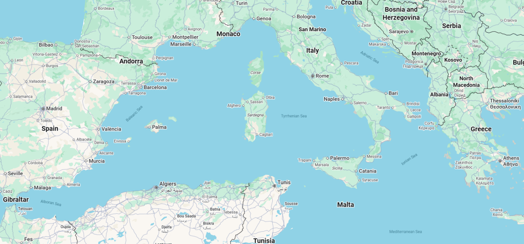
Fortunately, geography provides a quick cheat sheet. North-south, Sardinia sits half way between Genoa in Europe and Tunis in Africa. East-west, it’s about equidistant between Greece and Spain. This covers most of the Mediterranean, a cradle of civilizations. It was a quick sail for the Romans and Phoenicians, but it would have been more isolated a couple thousand years before Jesus and Caesar. Enough so as to foster its own unique cultures. Such as the Nuragic civilization. The tower building people.
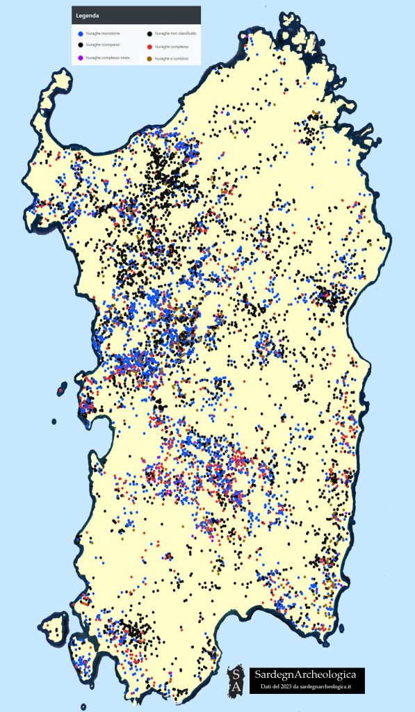
Rock and stone are not hard to find in Sardinia. As one rides across the island, it’s easy to come across whole piles of boulders. Some seemingly random, some once carefully arranged and now in partial disarray. The map above documents the locations of the latter.
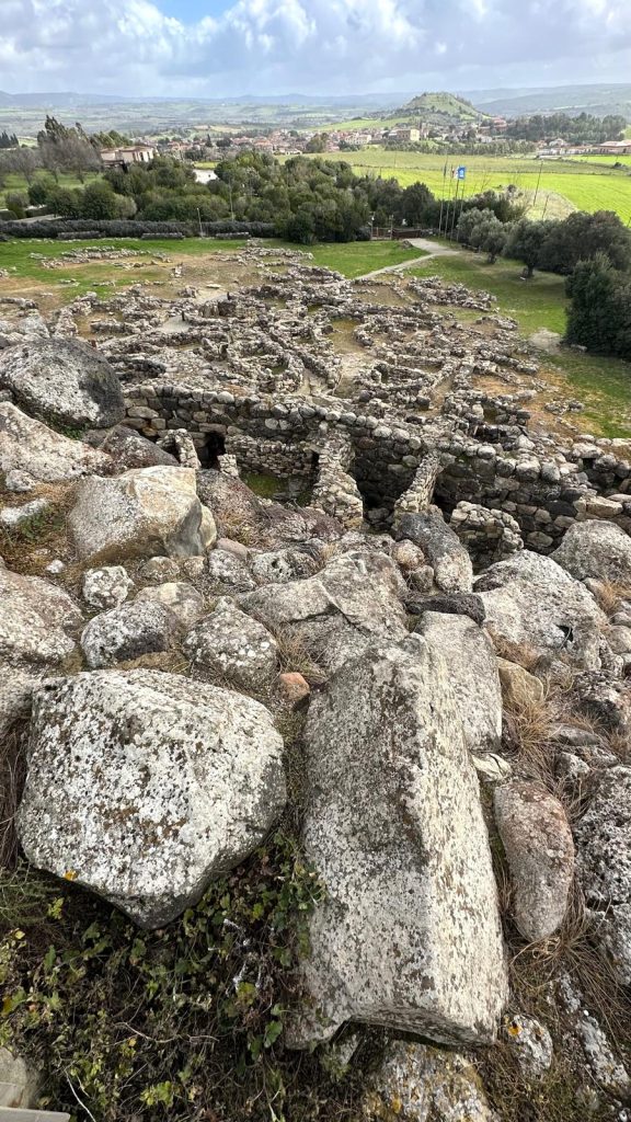
Among the ruined structures composed of megaliths, where shaping of stone by human hand can be clearly seen, vestiges of complete ancient settlements emerge. Rooms, benches, tables. All in stone.

The heart of each settlement consists of a tower, or several, with the first tower built on top of a water source. Above, a photo of a model we snapped at the Museo Archeologico in Cagliari.
We decided to see the most famous of these sites – Su Nuraxi di Barumini, which translates to The Nuraghe of Barumini in Sardinian, or Sardu as the speakers refer to the language itself. This also happens to be the only Nuraghe site recognized by UNESCO. The first megalithic construction here, later expanded on multiple occasions, dates as far back as 1500 BC.
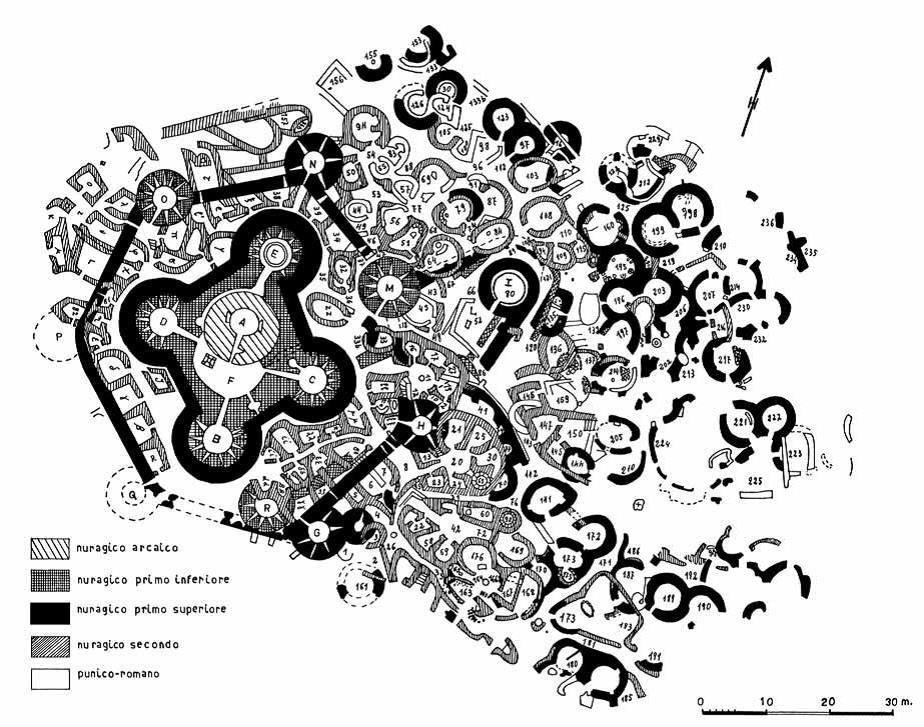
Image courtesy of Virtual Archelology
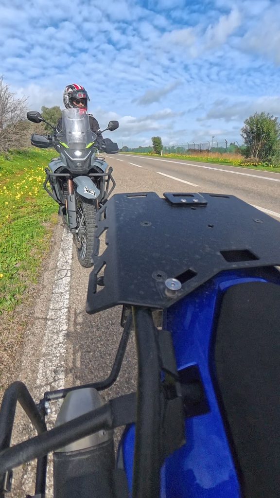
And so off to Barumini we went.
As always, we skipped the major highways.
In fact, we even tried to skip the asphalt altogether, but that didn’t go too well at first.
I use a lot of mapping apps. Gaia is my favorite for satellite views and BDRs. Avanza works well for overlaying traditional maps with a GPS location. Google remains a solid pick for A to B.
The app I decided to use on this ride is called OsmAndMaps. Not a particularly catchy name and I don’t know anyone using it in the US, but apparently the app is quite popular among the off-road crowd in Europe. I was introduced to it by Andrea, the owner of Aries Moto Tours in Malaga, Spain last year.
And this is what got us into minor trouble.
OsmAndMaps represents a pretty unique approach to mapping. It’s very good at what it does – namely finding dirt and allowing user customization – but does so using a UX that… defies convention. Yes, you can just download it and go, but be prepared for surprises. Better to take an hour or two to play with it at home first.
The app can also come across as a little aggressive. It will sniff out dirt anywhere. Including in the middle of the urban jungle. And the places you probably shouldn’t be, like the unmarked dirt alley behind the wall of a cement factory. It has no qualms about taking you places in the opposite direction on a designated one way street in a historic part of town or down a path of deep puddles cut off by a fence with little room to turn around. It will also expect you to get off a 110km highway onto a perpendicular dirt road with a 200m notice. You may be able to slide through the 90 degree turn at 100km/h, but whoever is following you is destined for the adjacent orange groves.
The previous paragraph is only a partial account of our numerous transgressions and mini adventures on this trip. We switched Osm off after about 20 minutes of unsolicited fun trying to get out of Cagliari. A boring Google ride would have to do if we were to reach Barumini before sundown.
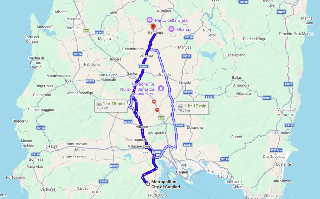
Getting to Barumini from Cagliari – without Osm – takes about an hour and 15 minutes.
And no, it wasn’t all that boring. Quite relaxing, in fact. Little traffic, too.

The hills and cactus visible above are pretty representative of the nicer sections of the ride. What’s particularly interesting here is that cacti are used as perimeter hedge. No electrification necessary.
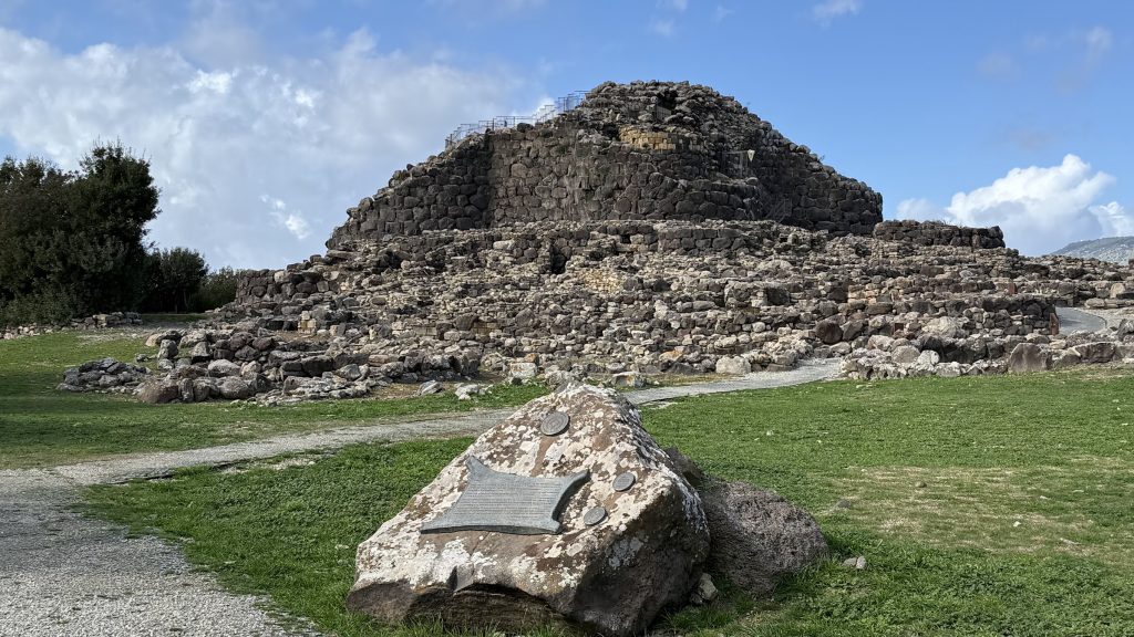
Once in Barumini, the Nuraghe site itself is only a couple kilometers west of town.
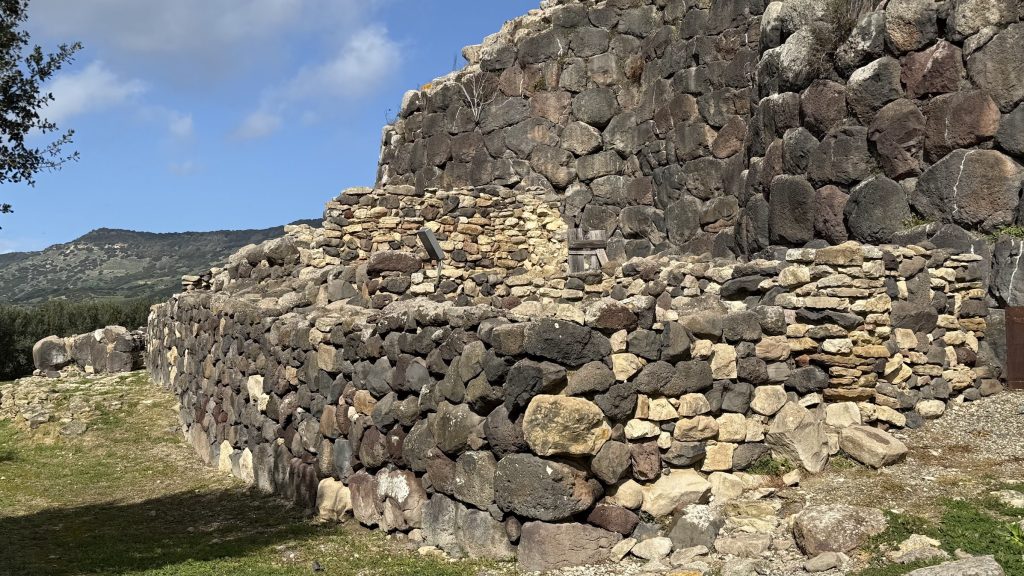
Access is available via pre-scheduled guided tours only. For a good reason. As we soon found out, getting inside of the stone structure consists of navigating narrow corridors and slippery stairs predating EU cultural site safety regulations by a good three thousand years.
Our guide spoke very good English and provided us with an excellent 45 min defacto private tour of the site, but it was the hand gestures and facial expressions that Min marveled over for hours afterward.

On the way back we decided to give OsmAndMaps another shot. We were surrounded by nothing but fields and villages, a more appropriate setting for its intended use. And this time the app did not disappoint. The single lane farm road lined with low grade tarmac and patches of dirt proved to be the highlight of our ride.
On mobile? Rotate to horizontal for larger view.
Here’s a 4 min section from about a 20 min ride between the villages of Barumini and Villanovafranca.
Recorded in 360 so don’t forget to spin around!

O man, fantastic. Great narrative Igor, great pictures. And this 360 footage is just heaven! Panning off to your right was unbelievably dramatic, mountains and a nice sense of distance. Puttering along, o man ………….

Your enthusiasm has me hitting the 360 record button twice as often, Todd 🙂 Two more 360s waiting for you here.

It’s why I ride buddy! (Tho to be honest I haven’t ridden very far in a while lol)
O that was me Todd in the last response………
[…] away from Pula. Although not nearly as well known, some consider it as significant as Pompeii. Barumini would have to do as our cultural visit for the week. We had a lot of ground to […]
[…] the following hour, as we rode up and down rolling hills not unlike those we’ve seen around Barumini, the cloud cover grew and the temperature dropped from 14C to 12C. We expected to see a low of 10C […]
Leave a Reply